GEOPROJET
Hydrogeology & Geophysics
GEOPROJET specializes in earth sciences and is involved in the creation of geological, geophysical, and geotechnical maps essential for the establishment of structures and mining, agricultural, or industrial projects in a given region. In this context, the studies conducted by the firm in various regions across the country and abroad are diverse and cover the following areas:
- Geophysical studies for the establishment of exploitation drillings.
- Research and prospecting of groundwater for water supply.
- Prospection of useful substances and implementation of beneficiation units.
- Geophysical studies for the exploration of quarries and sandpits.
- Geophysical studies for geological and mining investigations.
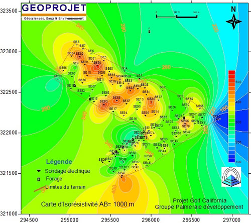
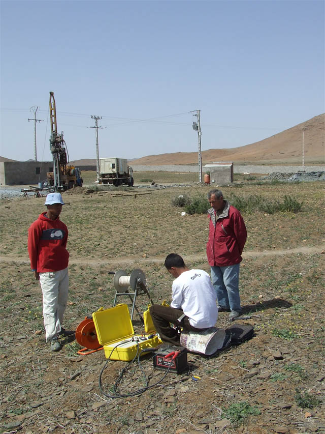
For water prospecting, we use different geophysical tools applied to the study and exploitation of groundwater resources. The methodology employed in this multidisciplinary approach has yielded successful results, including the discovery, for the first time, of exploitable water levels in the Tadla Plain (Dar Ould Zidouh and Nador), in the Bahira (Ouled Imloul and Aarab Essalam), in the Haouz Plain (Sidi Bou Othman, Mzoudiat), in the Tassaout Aval Plain (Sahrij), in the Saiss Plain (Hadj Kadour, Sbaa Aiyoun Meknes, Ouled Ammar, etc.), and the list is extensive. The company offers the following geophysical studies:
Electrical soundings
Electrical tomography
Electrical imaging
Resistivity panels (HR)
Ground electromagnetic coverage
Magnetometry and Gravimetry.